BHUARJAN
Field App
Digitise land surveys directly from the field. Capture Khasra data, GPS coordinates, owner details, and generate Form 10 reports — even in offline mode.
Every feature, right in your pocket
From project selection to PDF generation — see all key screens of the BHUARJAN Field App.
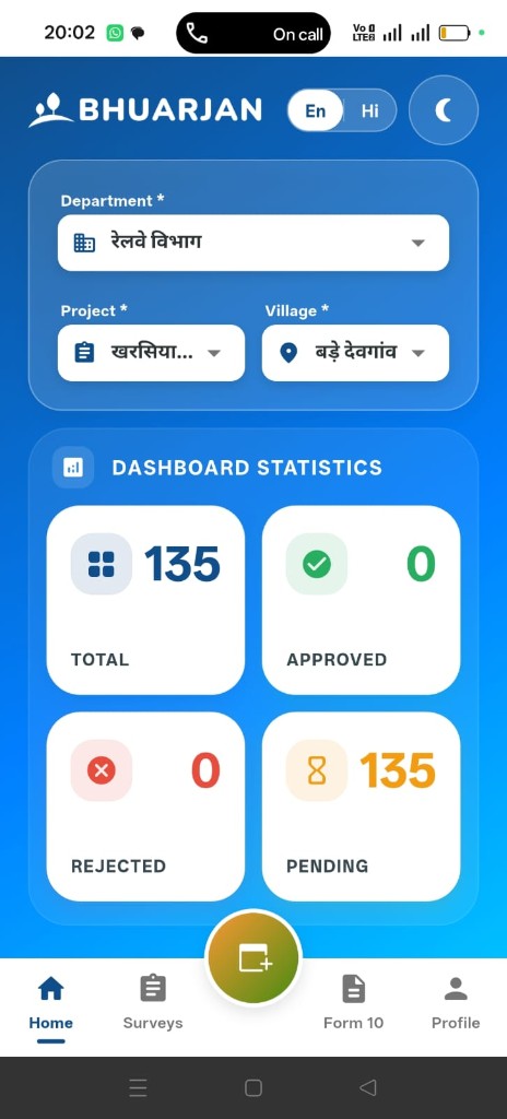
Home Dashboard
Instantly see project stats — Total, Approved, Rejected, and Pending surveys — filtered by Department, Project, and Village.
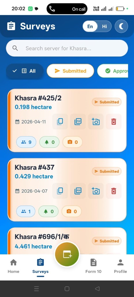
Surveys List
Browse and search all Khasra surveys with status badges. Filter by Submitted, Approved, or All — and access PDF, photos, and delete actions inline.
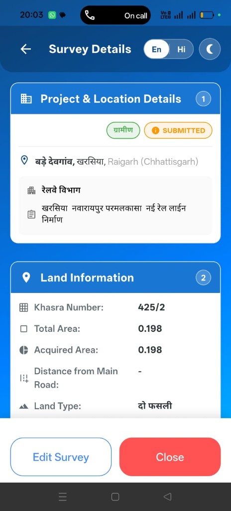
Survey Details
Full land record in one view — Project & Location, Khasra number, total & acquired area, land type, owner information, and acquisition status.

Form 10 — PDF View
Generate and preview the official Form 10 (भू-अर्जन प्रारंभिक सर्वे प्रपत्र) directly on your device. Download or share instantly with all parcel entries and authority signatures.
Built for field teams, loved by administrators
Offline First
Capture surveys with no internet. Data syncs automatically once connectivity is restored.
GPS & Mapping
Auto-capture precise GPS coordinates for each Khasra parcel during field visits.
Photo Evidence
Attach on-site photos to every survey record as visual proof of land conditions.
Form 10 Generation
Generate the official भू-अर्जन प्रारंभिक सर्वे प्रपत्र in one tap, ready for signatures.
Bilingual UI
Switch between Hindi and English instantly. Data entry and labels in both languages.
Dark Mode
Easy on the eyes during late-night or indoor data entry sessions with a tap.
Real-Time Sync
All data syncs instantly to the central BHUARJAN platform for admin review.
Role-Based Access
Patwari, RI, and Tehsildar each have tailored screens and permissions.
Available to authorised
government officials
The BHUARJAN Field App is distributed exclusively to authorised district administration officers. Contact us to get access for your team.